Updated 2:51 pm Saturday, March 15, 2025
In one of the hardest hit counties in Missouri—Butler County, emergency shelter is being set up at the Black River Coliseum in Poplar Bluff for those who need housing after the storm.
Initial reports from The Missouri State Emergency Management Agency indicate up to 19 tornadoes of varying strengths impacted 25 counties across the state.
The Missouri State Emergency Operations Center remains activated as state team members continue to respond to the devastating severe storms that caused significant damage to homes and buildings, led to widespread power outages, and caused multiple fatalities across the state.
At around 1:30 pm on Sat. March 15, electric service to multiple counties was in the process of being restored. The Missouri State Emergency Operations Center provided an update, and urged caution for residents.
Outages are decreasing as utility crews work to restore power in impacted communities (down from over 140,00 at 7am to under 110,000 this afternoon). SEMA and state response partners are working with local officials to begin the process of assessing damage for a potential federal disaster declaration request.
At this time, the Missouri State Highway Patrol has confirmed 10 fatalities. The state is working with local response agencies to gather additional information about serious injuries and will share more information as it becomes available.
“Friday and through the night, Missouri first responders, volunteers and our faith-based partners worked tirelessly in response to a series of devastating tornadoes and severe storms, and before that, dangerous and damaging fires,” said Governor Mike Kehoe.
Governor Kehoe continued with his show of support for the ongoing relief and rescue efforts in a press release.
“Our state team members and responders are working to support communities, have begun to assess the damage with local partners, and will be gathering more information in the coming days. I appreciate the heroic work of all those who are assisting their fellow Missourians. Our thoughts and prayers go out to the families grieving loved ones, and we stand with all those impacted by these devastating storms", said Kehoe.
Governor Kehoe declared a State of Emergency Friday, activating the State Emergency Operations Plan to support response and recovery efforts. The State Emergency Management Agency (SEMA) and Missouri State Highway Patrol continue to coordinate with local officials to assess damage and provide assistance.
UPDATE from the Poplar Bluff Library:
The Ridgel Branch of the Poplar Bluff Library sustained significant damage in last night's storm and will be closed for the foreseeable future. The Main Street branch does not have any detectable damage; however, we have made the decision to close Main Street until Monday to give staff time to focus on their families and any other recovery needs. Barring any unforeseen circumstances, the Main Branch will reopen at 9 a.m. on Monday and resume normal operating hours.
Updated 10:03 pm Friday, March 14
A Tornado Emergency was issued for Van Buren MO and Fremont MO, in effect until 10:15 PM. Find the latest alerts here.
Since Tuesday this week, the National Weather Service has been watching a strong weather system that threatens to produce damaging winds, large hail, and tornadoes as it moves across the quad state region from Friday through Saturday.
The storms are expected to be fast moving, possibly reaching up to 70 miles per hour.
A Tornado Watch is in effect until 11 pm Friday for multiple counties in Southeast Missouri.
Severe storms and heavy rain are possible Saturday, mainly over west Kentucky and southwest Indiana.
Around 4 pm Friday, the National Weather Service held a live event to discuss the threats to the region.
The National Weather Service says there is potential for 'a dangerous severe weather episode' Friday night across the area.
Thunderstorms are forecast to develop early this evening across Southeast Missouri, and then move east into the rest of the region through around 4 am Saturday.

Any storms that form will have the potential to produce strong tornadoes. Damaging winds and large hail will also be a threat.

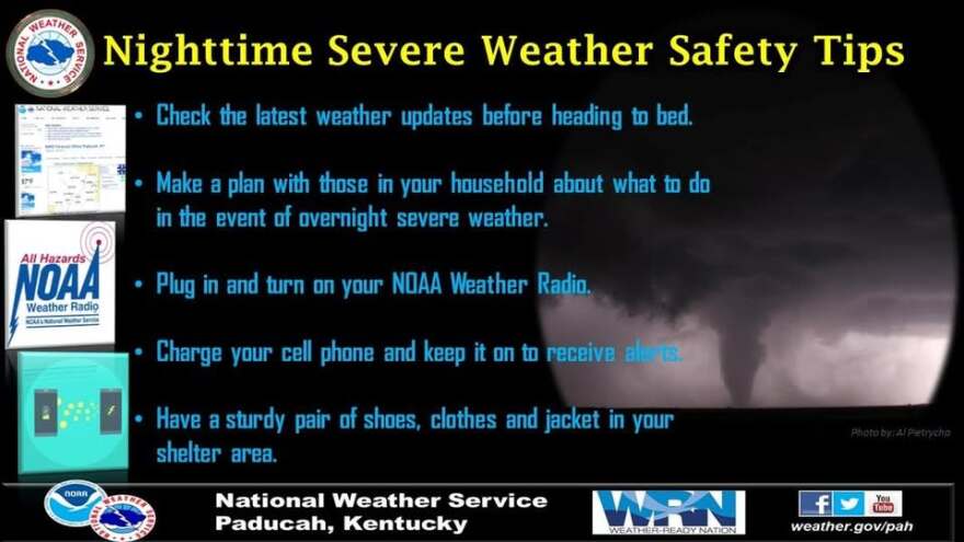
Having a shelter plan in place is highly recommended before the storms move into the area.

The National Weather Service in Paducah, Kentucky provided shelter guidelines early Friday afternoon.


